Understanding Maine’s Tides: A Vacationer’s Guide to the Coast
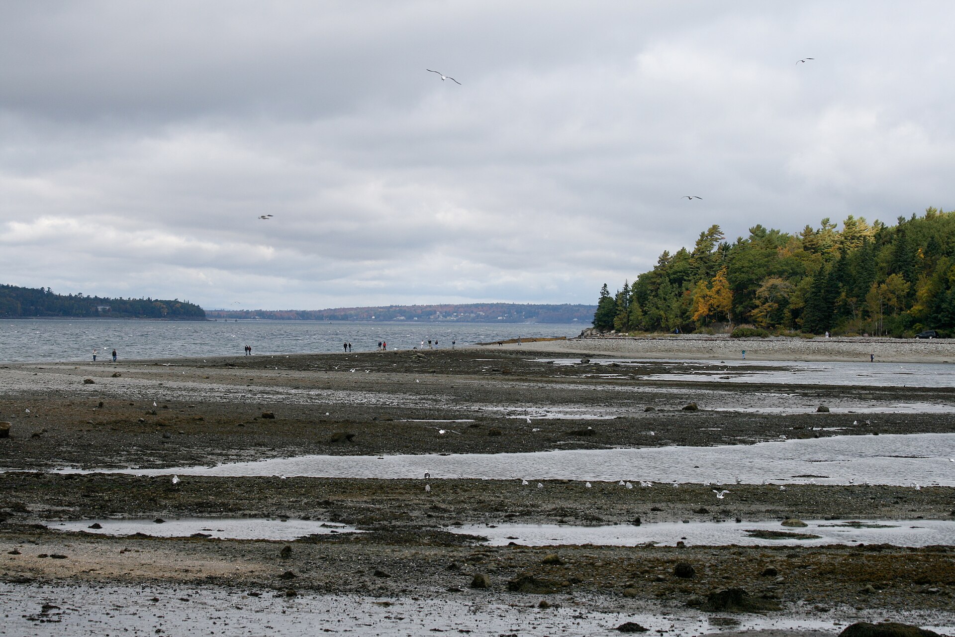
Along the coast of Maine, the tide is a constant companion — rising and falling twice a day, sometimes by twenty feet or more. It shapes the shoreline, the harbors, and the rhythm of coastal life, and knowing how it works will make any visit richer and safer, whether you are beachcombing, clamming, boating, or walking out to an island. Here is a guide to understanding Maine’s tides.
The Science Behind the Tides
Tides are driven by the gravitational pull of the moon and sun on the oceans. Maine, like the rest of the Atlantic coast, has a semidiurnal tide — two high tides and two low tides roughly every day, with about six hours and twelve minutes between a high and the following low. Because the moon orbits the Earth, the tides arrive about 50 minutes later each day. Around the full and new moon the swings grow largest (spring tides); near the quarter moons they are gentlest (neap tides).
How Big Are Maine’s Tides?
Maine’s tides grow dramatically as you travel Down East. In southern Maine, around Portland, the difference between high and low tide — the tidal range — is roughly 9 to 11 feet. Farther northeast, near Eastport and Cobscook Bay, the range swells to about 18 to 20 feet, the largest tides in the continental United States. And just beyond, the neighboring Bay of Fundy — on the Maine–Canada border — boasts the highest tides in the world, exceeding 50 feet at its head. The funnel shape of the coastline and sea floor is what amplifies the water to such heights.
Reading and Predicting the Tides
The good news is that tides are highly predictable. The National Oceanic and Atmospheric Administration (NOAA) publishes tide predictions for stations all along the Maine coast, and countless printed tide charts and smartphone apps put the day’s high and low times in your pocket. Remember that those times shift by roughly 50 minutes each day and vary from harbor to harbor, so check the chart for the specific spot you are visiting before you plan an outing on the water or the flats.
Tides and Safety
Big tides demand respect. On mudflats and sandbars the water can return surprisingly fast, and it is easy to get cut off. The classic example is the famous sandbar to Bar Island in Bar Harbor: for roughly an hour and a half to two hours on either side of low tide, you can walk the exposed gravel bar out to the island — but once the tide turns, it covers the bar for about nine hours. Lose track of time and you could be stranded, facing cold water and strong currents. Wherever you explore the shore, check a tide chart, set a firm time to turn back, and keep an eye on the water. The tide waits for no one.
Tide Pools and the Flats
Low tide is when the coast gives up its treasures. Rocky tide pools come alive with sea stars, green urchins, crabs, periwinkles, and anemones, while broad mudflats and salt marshes — like Scarborough Marsh, the largest in Maine — draw herons, egrets, and shorebirds. Low tide is also when Mainers head out to dig soft-shell clams, the beloved “steamers,” though clamming is regulated and often requires a local license. Whatever you seek, tread lightly on these fragile living communities and put back anything you turn over.
The Old Sow and the Great Down East Tides
Nowhere is the power of Maine’s tides more astonishing than Down East. Off Eastport churns the Old Sow, the largest tidal whirlpool in the Western Hemisphere, created as huge volumes of water surge between Passamaquoddy Bay and the Bay of Fundy. Nearby Cobscook Bay — whose name is said to mean “boiling tides” — and its reversing falls put on a similar show, as rapids literally change direction with the turning tide. It is a humbling reminder of the ocean’s daily muscle.
Experiencing the Tides
The best way to appreciate the tides is to watch them at work — visit a favorite spot at high tide and return a few hours later at low to see how completely the scene transforms. The tidal marshes near Prouts Neck in Scarborough and the broad sand flats of Popham Beach near Bath are wonderful places to feel the rhythm of the sea. Travelers making their way inland along the tidal Kennebec will find our own town of Winslow, where Fort Halifax has watched the river rise and fall since 1754.
Frequently Asked Questions
How many tides does Maine have each day?
Maine has a semidiurnal tide, meaning two high tides and two low tides roughly every day, with about six hours and twelve minutes between a high tide and the following low.
How big are the tides in Maine?
The tidal range is about 9 to 11 feet in southern Maine around Portland, growing to roughly 18 to 20 feet Down East near Eastport — the largest tides in the continental U.S. The adjacent Bay of Fundy has the highest tides in the world, over 50 feet.
Are Maine’s tides dangerous?
They can be if you are careless. On mudflats and sandbars — such as the bar to Bar Island in Bar Harbor — the incoming tide can cut you off, leaving you stranded for hours in cold water. Always check a tide chart and set a time to turn back.
Where can I see the biggest tides in Maine?
Head Down East to the Eastport and Cobscook Bay area, where tides reach 18 to 20 feet and the Old Sow whirlpool churns — the gateway to the world’s highest tides in the Bay of Fundy.