Exploring the Northern Half of Baxter State Park: Maine's Wild North Country
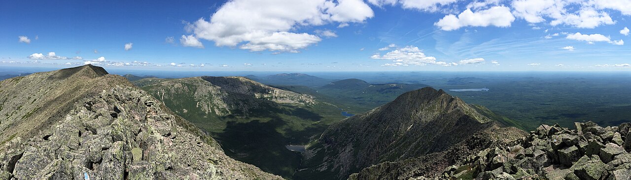
Most visitors to Baxter State Park come for Mount Katahdin, the great mountain that crowns its southern end. But head north, and you find a wilder, quieter Baxter — a realm of clear ponds, rugged peaks, and deep forest where the crowds thin and the wilderness takes over. For hikers and paddlers who crave solitude, the northern half of the park is one of Maine's true wild treasures.
A “Forever Wild” Wilderness
Baxter State Park exists thanks to the vision of former Maine governor Percival P. Baxter, who bought the land piece by piece over decades and gave it to the people of Maine with a simple, powerful mandate: that it remain “forever wild.” True to that spirit, the park is managed with a light hand — unpaved roads, rustic campgrounds, and strict limits on development and crowds. It is a place designed to protect wilderness first and foremost.
The North Entrance: Matagamon Gate
The northern half of the park is reached through the Matagamon Gate, near Matagamon Lake and the East Branch of the Penobscot River. This is remote country — the drive in takes you well off the beaten path — and that isolation is exactly the appeal. Once inside, gravel roads lead to trailheads, ponds, and campgrounds far from the busier Katahdin area to the south.
South Branch Pond
One of the jewels of the north is South Branch Pond, a beautiful spot ringed by steep, forested mountains. Its rustic campground sits right on the water, and the pond is perfect for a paddle, a swim, or simply soaking in the view, with trailheads for the surrounding peaks close at hand. For many, a stay here is the highlight of a northern Baxter trip.
The Traveler
Rising above the northern part of the park is the Traveler, a rugged mountain of volcanic origin. It is renowned among Maine hikers for its long, exposed ridges and extensive open terrain — some of the largest stretches of above-treeline hiking in the state outside of Katahdin itself. The routes here are challenging and rewarding, offering huge views over an ocean of forest, ponds, and distant summits.
Rustic by Design
Visiting Baxter is not like visiting a typical park. Campgrounds have no electricity or running water, cell service is spotty or absent, and you are expected to be self-sufficient — carrying in what you need and carrying out all your trash. There are also limits on vehicle size, day-use parking, and group sizes. These rules can feel strict, but they are what keeps Baxter wild.
Planning Your Visit
Because access and camping are limited, planning ahead is essential. Reservations are typically required for campsites, and popular day-use trailheads can fill early in peak season. Rules, road conditions, and reservation details change from year to year, so always check with the Baxter State Park Authority for current information before you go. Come prepared for cool weather, rugged trails, and true remoteness — and you will be rewarded with wilderness at its finest.
Frequently Asked Questions
How do you get to the northern half of Baxter State Park?
The north end is reached through the Matagamon Gate, near Matagamon Lake and the East Branch of the Penobscot River, via remote roads north of the park's busier Katahdin area.
What is there to do at South Branch Pond?
South Branch Pond offers a waterside rustic campground, paddling and swimming on a pond ringed by mountains, and trailheads for hikes into the surrounding peaks.
Is the northern half of Baxter less crowded?
Yes. The northern section sees far fewer visitors than the Katahdin area to the south, making it a quieter, more remote wilderness experience.
Do I need a reservation for Baxter State Park?
Camping typically requires a reservation, and busy day-use trailheads can fill up. Because rules change, check with the Baxter State Park Authority for current reservation and access information before your trip.